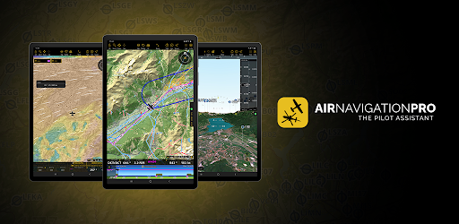
Air Navigation Pro on Windows Pc
Developed By: Xample Sarl
License: Free
Rating: 3,6/5 - 4.704 votes
Last Updated: February 25, 2025
App Details
| Version |
8.3.452.503030911 |
| Size |
166.9 MB |
| Release Date |
March 09, 25 |
| Category |
Maps & Navigation Apps |
|
App Permissions:
Required to be able to access the camera device. [see more (11)]
|
|
What's New:
-Planned Altitude Label in the Profile View: The intended route track now includes labels indicating the planned altitude for each leg-New Navigation Bar... [see more]
|
|
Description from Developer:
Discover our flight planning & real-time navigation app for free for 28 days!
- Everything you need to fly around the world
- Plan your flight in a few minutes
- Fly relaxed wi... [read more]
|
About this app
On this page you can download Air Navigation Pro and install on Windows PC. Air Navigation Pro is free Maps & Navigation app, developed by Xample Sarl. Latest version of Air Navigation Pro is 8.3.452.503030911, was released on 2025-03-09 (updated on 2025-02-25). Estimated number of the downloads is more than 100,000. Overall rating of Air Navigation Pro is 3,6. Generally most of the top apps on Android Store have rating of 4+. This app had been rated by 4,704 users, 1,423 users had rated it 5*, 2,615 users had rated it 1*.
How to install Air Navigation Pro on Windows?
Instruction on how to install Air Navigation Pro on Windows 10 Windows 11 PC & Laptop
In this post, I am going to show you how to install Air Navigation Pro on Windows PC by using Android App Player such as BlueStacks, LDPlayer, Nox, KOPlayer, ...
Before you start, you will need to download the APK/XAPK installer file, you can find download button on top of this page. Save it to easy-to-find location.
[Note] You can also download older versions of this app on bottom of this page.
Below you will find a detailed step-by-step guide, but I want to give you a fast overview of how it works. All you need is an emulator that will emulate an Android device on your Windows PC and then you can install applications and use it - you see you're playing it on Android, but this runs not on a smartphone or tablet, it runs on a PC.
If this doesn't work on your PC, or you cannot install, comment here and we will help you!
Step By Step Guide To Install Air Navigation Pro using BlueStacks
- Download and Install BlueStacks at: https://www.bluestacks.com. The installation procedure is quite simple. After successful installation, open the Bluestacks emulator. It may take some time to load the Bluestacks app initially. Once it is opened, you should be able to see the Home screen of Bluestacks.
- Open the APK/XAPK file: Double-click the APK/XAPK file to launch BlueStacks and install the application. If your APK/XAPK file doesn't automatically open BlueStacks, right-click on it and select Open with... Browse to the BlueStacks. You can also drag-and-drop the APK/XAPK file onto the BlueStacks home screen
- Once installed, click "Air Navigation Pro" icon on the home screen to start using, it'll work like a charm :D
[Note 1] For better performance and compatibility, choose BlueStacks 5 Nougat 64-bit read more
[Note 2] about Bluetooth: At the moment, support for Bluetooth is not available on BlueStacks. Hence, apps that require control of Bluetooth may not work on BlueStacks.
How to install Air Navigation Pro on Windows PC using NoxPlayer
- Download & Install NoxPlayer at: https://www.bignox.com. The installation is easy to carry out.
- Drag the APK/XAPK file to the NoxPlayer interface and drop it to install
- The installation process will take place quickly. After successful installation, you can find "Air Navigation Pro" on the home screen of NoxPlayer, just click to open it.
Discussion
(*) is required
Discover our flight planning & real-time navigation app for free for 28 days!
- Everything you need to fly around the world
- Plan your flight in a few minutes
- Fly relaxed with up-to-date information
Air Navigation Pro is a high-quality flight assistant app for pilots worldwide. Benefit from the following main features:
MOVING MAP
Plan and navigate using our interactive moving map. Choose between aeronautical charts, satellite or our vector map as a background. On top of that, the moving map displays waypoints, NOTAM, obstacles and airspaces from our comprehensive, always up-to-date worldwide aeronautical database. Tap on any waypoint directly on the map to easily create a route. Personalize the values shown on the navbar to have exactly the information you need: altitude, vertical speed, bearing, distance to the next waypoint, ETA calculations, etc. Choose the airport departure and arrival procedures for your route to have them also displayed on top of the moving map.
ENHANCED TRAFFIC AWARENESS
Get visual and audio alerts in all languages for nearby conflicting traffic. Choose your preferred traffic icon between generic, aircraft or TCAS symbols. Your safety is important to us, which is why we partnered with SafeSky to ensure our users have live traffic data during their flight. Benefit from the native integration with SafeSky included in our new Smart Lite, Smart Classic and Smart Advanced subscriptions—a two-in-one package!
ADVANCED WEATHER LAYERS
In addition to the basic weather reports of winds and TAF/METAR for your flight, subscribers of the Smart Advanced plan can activate see-through weather layers on top of the moving map. Available layers include rain radar, wind, pressure, clouds and rain, visibility, gust and additionally for Germany, Switzerland, Austria and the Balkans, GAFOR reports. Tap on any point on the map to see the weather information for that area. Review the weather forecast for up to three days ahead.
NOTAM
After creating your route, set the departure time in the future to have the moving map display the NOTAM active for that specific time. NOTAM on the map change color dynamically based on their status.
SMARTCHART
Our cutting-edge SmartChart is a highly detailed and intelligent vector-based map that adapts to your needs, providing you with adequate information at any zoom level. The SmartChart optimizes the display of shadows to easily distinguish between valleys and mountains, and the text remains perfectly aligned, guaranteeing optimal readability. Including the latest significant improvements with forests and detailed airport information.
ELEVATION PROFILE & SYNTHETIC VIEW
Enable the profile view below the navbar for enhanced situational awareness of the elevation ahead of you or along your route. Choose the corridor width between 0 to 5 NM and overlay options: airspaces, NOTAM, obstacles, wind components, populated places, etc. Switch to the synthetic view for additional terrain information, plus an artificial horizon with altitude and vertical speed indicators. This function can also be used to pan around while preparing for your flight. Activate TAWS on the moving map as well as on the synthetic view.
AERONAUTICAL CHARTS & APPROACH CHARTS
We offer the most extensive worldwide catalog of aeronautical charts, including the ICAO charts. Have the georeferenced approach charts displayed on top of the moving map or the synthetic view.
BRIEFING
Prepare your flight with our briefing section by creating documents with NOTAM and weather charts & stations relevant to your planned route. Optimize time by creating an aircraft profile which will be used in the Briefing section to pre-fill for you the ATC Flight Plan and calculate the W&B.
AND SO MUCH MORE!
A subscription allows you to use the app on three devices. We recommend creating an Air Navigation account for improved device management. Refer to our user manual on our website: www.airnavigation.aero for more information.
-Planned Altitude Label in the Profile View: The intended route track now includes labels indicating the planned altitude for each leg
-New Navigation Bar Fields: XTE (Cross Track Error) and Planned Altitude
-Bug Fixes & Stability Improvements: A smoother and more reliable experience with enhanced performance
Required to be able to access the camera device.
Allows an app to access approximate location.
Allows an app to access precise location.
Allows an application to write to external storage.
Allows applications to open network sockets.
Allows applications to access information about networks.
Allows applications to access information about Wi-Fi networks.
Allows using PowerManager WakeLocks to keep processor from sleeping or screen from dimming.
Allows access to the list of accounts in the Accounts Service.
Allows an app to use fingerprint hardware.
Allows an application to read from external storage.